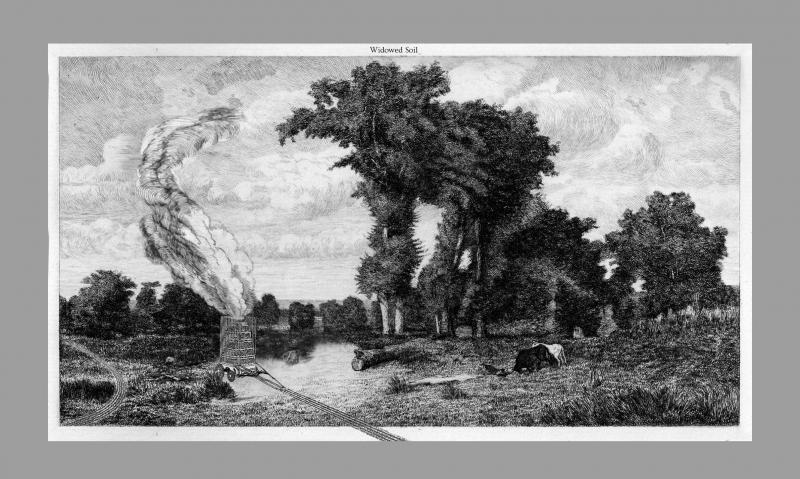
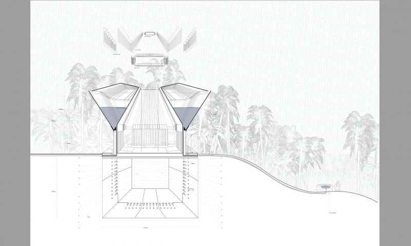
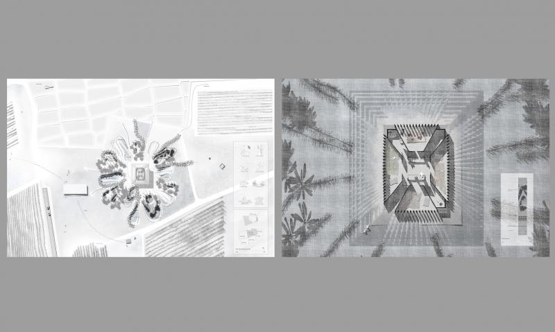
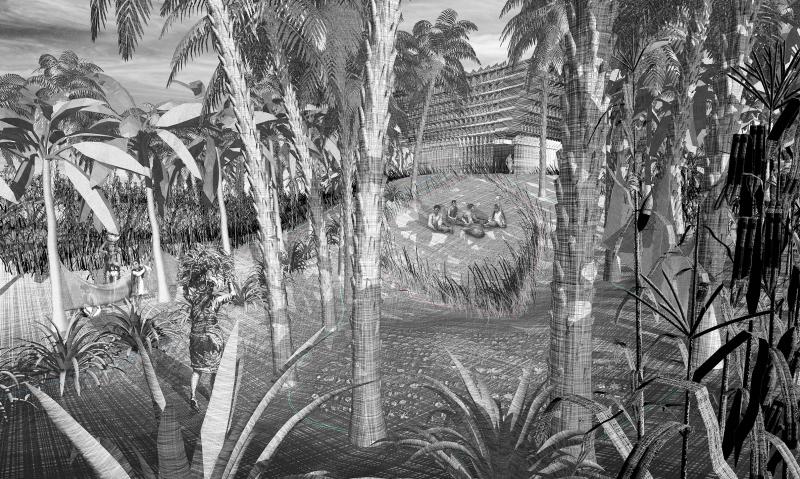
INTER-03

The Widowed Soil Organisation defies the current order of land ownership in the rural setting of north sri Lanka.
By acknowledging the authority of drawing a line on the ground which is not a border but a trace of the life on that land, a land reclaiming apparatus will carve the history of Sri Lanka’s war widows on the soil of their lost lands, in the form of a new farm.
With the use of landscape tool to re-define the domestic use of space under a new shared ownership in the traditional home farm, the organisation first collects land testimonies from the widows in the form of map biographies, and then translates them to a series of crops enclosed zoned surrounding the water tank roofed house. The farm presents a threshold of a public to private use of the land surrounded by buffer zones which helps slowly reintroduce the new community of female farmers to the agrarian north.

SELECT * FROM students_images2 WHERE student_id = 2473 AND is_visible = 1 ORDER BY sort_order

Widowed Soil

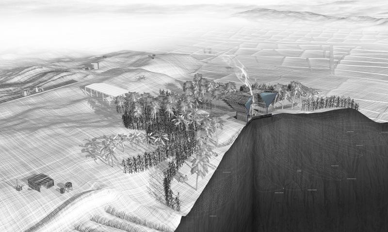
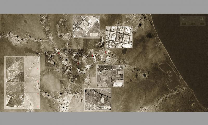
The Widowed Soil organisation defies the current order of land ownership in the rural setting of north Sri Lanka.
By acknowledging the authority of drawing a line on the ground which is not a border but a trace of the life on that land,
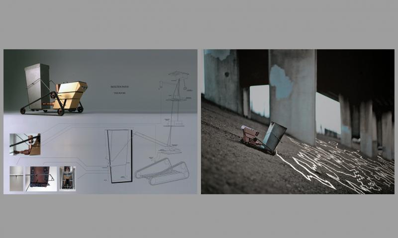
A land reclaiming apparatus will carve the history of Sri Lanka’s war widows on the soil of their lost lands, in the form of a new farm .

Rover Furnace

at the beginning of the year I have experimented with superimposing alternative cartographies and the act of demarcation by building a rover using Arduino interface which draws a map of molten metal on the land.

to understand the capacity of such an act to form a new law I studied the case of the great Ngurrara Canvas: an 8 by 10 meter map drawn by 40 aboriginal artists to describe their connection to their land. The map was accepted in court and they reclaimed 76,000 square kilometres of land.

Expedition 1

The Rover Furnace charting new lands and laying a map of molten metal on the ground

Widowed Soil

The first step of the process of reclaiming the land is collecting a testimony from the widow who wished to reclaim her land in the form of a map biography.
The widow describes her life on the land in relation to farm activities,family activities, zones and memories, and the map she draws is scanned and translated into a set of relevant spatial parameters.
The most constant activity described by all widows - carrying water, defines the core element of the farm : the water tank roofed house, which relieves the widows from this task.
The rest of the activities are assigned specific zones around the house and irrigation lines which stem from the house are laid around these zones.

Curiyan Farm Section

Curiyan Farm Section

Crops and Rituals catalogues

Crops and Rituals catalogues

The Curiyan Farm House

the shape of the section comes first and foremost - to achieve maximum efficiency in collecting the rainwater and draining them down through the piped colonnade, to the foundation where the taps are and to the irrigation lines which sometime connect to an external water source.
the whole structure is lightweight and held down by the weight of the water

Farm plan and house plan

Right: Curiyan farmhouse plan.

Left: Curiyan farm plan.

Life Between the Crops

A view into the different appropriations of the zones enclosed between the crops around the house

Widowed Soil Map

Each of these farms is a node, it functions autonomously. even though they are all under the authority of the widowed soil organisation, they are not connected by a network but by their interwoven history and circumstances.
this map is stripped-down of all information except for the ancient irrigation tanks around which the settlements of the north are organized.
the same logic applies to the Curiyanfarm whereas the community of widows live around the water tank.
In this map there are 4 farms in 4 different stages:
Under construction
Not yet grown
Fully grown
Fully integrated